Introduction
In today’s fast-paced world, healthcare providers face growing challenges in delivering timely, accurate, and efficient patient care. Emergencies such as heart attacks, strokes, accidents, and infectious disease outbreaks require rapid response, precise coordination, and access to critical information. This is where GEO Services are transforming healthcare systems by enhancing emergency response, improving patient outcomes, and optimizing medical resource management.
Through location-based technologies, healthcare professionals can track ambulances, manage patient transport, prioritize high-risk cases, and allocate resources more effectively. Adomantra, a leader in location intelligence, leverages advanced GEO Services to support hospitals, emergency services, and public health organizations in providing better care to patients when it matters most.
This blog explores how GEO Services are revolutionizing healthcare by offering real-time tracking, location analytics, and data-driven decision-making. We will delve into their applications in emergency response, patient care, and healthcare logistics while highlighting how Adomantra is contributing to this transformation.
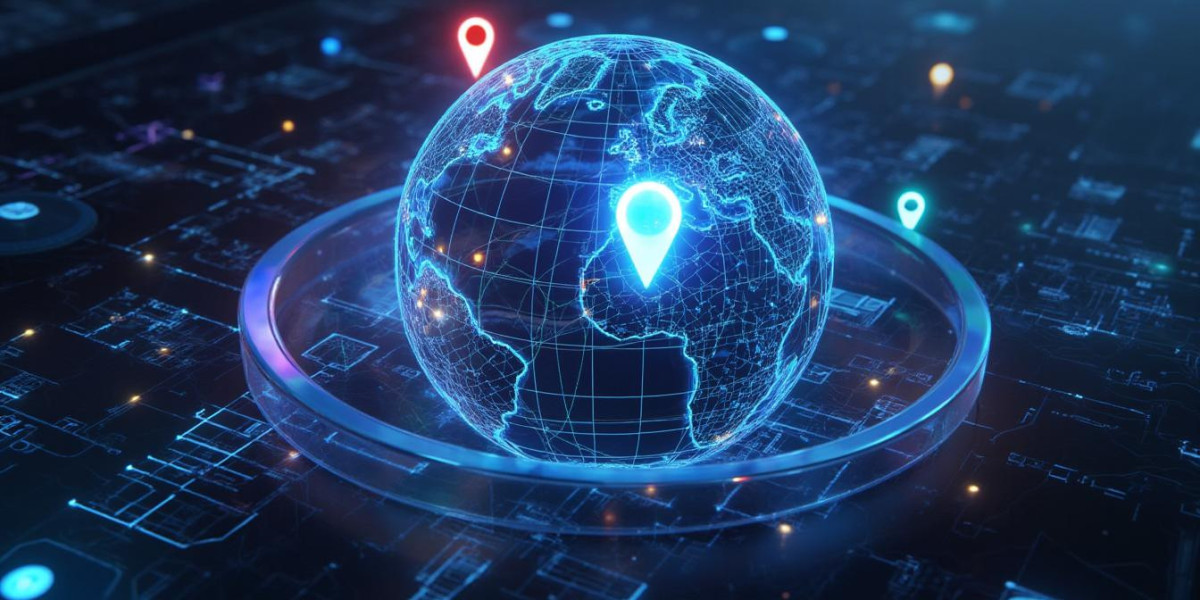
What are GEO Services?
GEO Services, short for Geographic Information System (GIS)-based solutions, involve the collection, analysis, and visualization of spatial and location data. By integrating maps, satellite imagery, GPS tracking, and sensor data, these services enable healthcare providers to make informed decisions based on where patients, resources, or risks are located.
Some key components of GEO Services include:
Real-Time Location Tracking – Monitoring ambulances, healthcare workers, and mobile clinics.
Geospatial Analytics – Identifying patterns in disease outbreaks or resource shortages.
Route Optimization – Ensuring ambulances or patient transport vehicles take the fastest or safest routes.
Resource Allocation – Mapping hospitals, pharmacies, and medical supplies to areas of highest demand.
Emergency Alerts – Using location data to trigger notifications for nearby healthcare providers.
These services play a critical role in addressing the logistical challenges of modern healthcare, making them indispensable in emergency management and everyday patient care.
The Role of GEO Services in Emergency Response
Emergency situations are chaotic by nature. Seconds matter, and every decision can have life-or-death consequences. Here’s how GEO Services improve emergency response in healthcare.
1. Real-Time Ambulance Tracking
Ambulances are often the first line of defense in medical emergencies. GEO Services allow emergency dispatchers to track ambulance locations in real time, ensuring that the nearest available unit is sent to a patient.
For instance, during a heart attack or stroke, minutes lost can result in permanent damage. By using GEO Services, medical teams can:
Quickly identify the nearest ambulance.
Avoid traffic jams by rerouting vehicles.
Provide estimated arrival times to emergency rooms.
Monitor ongoing trips for status updates.
This level of responsiveness helps reduce response times, improving patient survival rates.
2. Coordinating Multi-Agency Responses
Natural disasters, mass accidents, or pandemics require coordination between multiple agencies. With GEO Services, emergency services such as fire departments, police, and hospitals can share location data and map high-risk zones together.
For example, during a flood or earthquake, GEO Services can:
Map blocked routes and unsafe areas.
Direct ambulances through alternate paths.
Identify shelters and hospitals with available capacity.
Help prioritize rescue efforts based on population density and risk areas.
This ensures seamless communication and collaboration during emergencies.
3. Managing Infectious Disease Outbreaks
During outbreaks like COVID-19, tuberculosis, or seasonal flu, tracking clusters of infection is vital for containment. GEO Services assist in identifying hotspots by mapping patient locations, travel histories, and testing sites.
Hospitals and health departments can then:
Set up temporary treatment centers in areas with high infection rates.
Send mobile clinics to underserved neighborhoods.
Monitor patient movement to predict future outbreaks.
This spatial insight helps healthcare providers deploy resources proactively, rather than reactively.
Enhancing Patient Care with GEO Services
Beyond emergency situations, GEO Services offer long-term benefits in patient care and healthcare logistics.
1. Optimizing Hospital Operations
Hospitals are complex environments where patient flow, bed management, and resource utilization need constant oversight. GEO Services allow administrators to:
Track the availability of beds and equipment.
Predict patient arrival times for better scheduling.
Monitor medical staff locations for efficient deployment.
This leads to smoother operations, reduced wait times, and better patient satisfaction.
2. Personalized Healthcare and Remote Monitoring
With wearable devices and mobile health apps, patient health data is now more accessible than ever. GEO Services help healthcare providers monitor patients remotely, especially in rural or underserved areas.
For example:
A wearable heart monitor can alert doctors if a patient’s vital signs indicate distress.
Location tracking ensures that medical teams can quickly reach patients needing urgent care.
Data from chronic disease management programs can be analyzed to detect trends and intervene early.
These solutions extend care beyond hospital walls, offering patients continuous monitoring and faster interventions.
3. Improving Access to Care in Rural Areas
Rural and remote communities often face challenges in accessing healthcare services. GEO Services help map underserved regions and plan outreach initiatives such as:
Mobile medical units traveling along optimized routes.
Telemedicine services directed toward areas with poor healthcare access.
Local health awareness campaigns based on regional data.
This targeted approach ensures that healthcare services reach those most in need.
How Adomantra is Leading the Way with GEO Services
Adomantra is at the forefront of transforming healthcare through location intelligence. By integrating advanced GEO Services into emergency management systems and healthcare logistics, Adomantra empowers hospitals, emergency responders, and public health agencies to act faster, smarter, and more efficiently.
Adomantra’s Key Offerings Include:
Customized Location-Based Dashboards: Providing healthcare administrators with visual insights into patient flow, resource allocation, and emergency hotspots.
Ambulance Tracking Solutions: Enabling real-time updates on vehicle locations, routes, and traffic alerts.
Predictive Analytics: Using historical data and location trends to forecast emergencies and allocate resources ahead of time.
Mobile Health Integration: Supporting remote patient monitoring by integrating GPS data with health apps and wearable devices.
With Adomantra’s solutions, healthcare providers can reduce response times, improve patient outcomes, and better serve communities.
Challenges and Considerations in Implementing GEO Services
While GEO Services offer significant benefits, healthcare providers need to address certain challenges to maximize their impact.
1. Data Privacy and Security
Patient location data is sensitive and must be protected under privacy laws such as HIPAA. Healthcare providers must ensure:
Data encryption and secure storage.
Controlled access to location data.
Compliance with regional data protection laws.
Adomantra assists organizations in implementing robust security protocols that safeguard patient privacy while enabling real-time tracking.
2. Infrastructure and Connectivity
For GEO Services to work effectively, stable internet connections and GPS-enabled devices are required. In areas with poor infrastructure, alternative solutions such as satellite communication may be necessary.
3. Integration with Existing Systems
Healthcare systems often rely on multiple software platforms. Integrating GEO Services without disrupting workflows requires:
Seamless APIs.
Staff training.
Continuous support and monitoring.
Adomantra’s modular and customizable solutions make this integration easier, offering tailored implementations for diverse healthcare environments.
Future Trends: GEO Services and Healthcare Innovation
As technology advances, GEO Services are expected to play an even larger role in healthcare innovation.
AI-Driven Location Insights
Artificial intelligence combined with geographic data can predict patient surges, optimize ambulance dispatching, and identify health trends before they become crises.
Smart Wearables and IoT Integration
More wearable devices will incorporate location data to offer personalized health alerts, particularly for elderly patients and those with chronic conditions.
Cross-Sector Collaboration
Partnerships between healthcare providers, government agencies, and private companies will enhance disaster preparedness, health education, and patient outreach through shared location data platforms.
Conclusion
The integration of GEO Services into healthcare systems marks a transformative shift in how medical emergencies are managed and patient care is delivered. From tracking ambulances in real time to identifying disease outbreaks and optimizing hospital operations, location intelligence empowers healthcare providers to act faster and more accurately.
Adomantra’s commitment to enhancing healthcare through advanced GEO Services ensures that hospitals, emergency responders, and public health agencies are equipped with the tools needed to save lives and improve patient outcomes.
As healthcare continues to evolve, the role of geospatial technology will only grow more significant, making it a vital part of tomorrow’s healthcare solutions.
Frequently Asked Questions (FAQ)
1. What are GEO Services in healthcare?
GEO Services are location-based technologies that collect, process, and analyze geographic data to improve healthcare delivery. These services use GPS tracking, satellite imagery, and real-time mapping to monitor ambulances, patients, medical facilities, and disease outbreaks. By providing actionable location insights, GEO Services enhance emergency response, optimize patient care, and support healthcare logistics.
2. How do GEO Services improve emergency response in healthcare?
GEO Services allow emergency medical teams to track ambulances in real time, identify the nearest available units, and route them efficiently to patient locations. This significantly reduces response time, ensuring that medical help arrives quickly, especially in life-threatening situations such as heart attacks, strokes, or accidents.
Additionally, GEO Services assist in coordinating between hospitals, first responders, and public health agencies by sharing location data, mapping critical areas, and planning emergency routes during disasters or mass-casualty incidents.
3. Can GEO Services help hospitals manage patient care outside of emergencies?
Yes. GEO Services are equally beneficial in non-emergency healthcare operations. Hospitals can use location data to monitor patient flow, track equipment availability, and schedule staff efficiently. Remote patient monitoring using GPS-enabled devices helps track patients with chronic conditions or those recovering at home. It ensures timely medical intervention and reduces unnecessary hospital visits.
4. How does Adomantra’s GEO Services support healthcare providers?
Adomantra provides customized location intelligence solutions tailored to healthcare needs. Their GEO Services include real-time ambulance tracking, predictive analytics, geospatial dashboards, and mobile health integration. These services enable hospitals and emergency response teams to make data-driven decisions, improve patient care, and allocate resources effectively while ensuring data security and compliance with privacy regulations.
5. How are GEO Services used to track ambulances and medical transport?
Ambulances equipped with GPS trackers share real-time location data with dispatch centers and hospitals. GEO Services help monitor the vehicle’s current position, speed, and traffic conditions. Based on this information, dispatchers can reroute ambulances to avoid delays, inform receiving hospitals of arrival times, and prioritize cases based on urgency, ensuring patients receive the right care at the right time.
6. Can GEO Services help manage infectious disease outbreaks?
Absolutely. GEO Services help health authorities map disease hotspots by analyzing patient locations, travel patterns, and demographic data. During outbreaks like COVID-19 or dengue fever, this information is used to:
Identify areas at high risk of infection.
Deploy testing and vaccination centers strategically.
Monitor patient movement and contact tracing.
Predict future outbreak zones using historical data.
This proactive approach helps contain diseases and reduces strain on healthcare systems.
7. How do GEO Services enhance healthcare access in rural or underserved areas?
Rural areas often suffer from limited medical facilities and poor transportation infrastructure. GEO Services address this gap by:
Mapping underserved regions to plan mobile clinics and outreach programs.
Tracking patient travel patterns to suggest healthcare facilities nearby.
Optimizing ambulance routes to ensure faster medical response.
Supporting telemedicine services by integrating location data with healthcare apps.
Through location intelligence, GEO Services ensure equitable healthcare access, regardless of geography.
8. Are patient privacy and data security a concern with GEO Services?
Yes, protecting patient data is a top priority. GEO Services collect sensitive location information, so healthcare providers must adhere to strict security protocols and data protection laws like HIPAA. This includes:
Encrypting data in transit and at rest.
Limiting access to authorized personnel.
Anonymizing data where possible.
Implementing audits and compliance checks.
Adomantra integrates robust security measures into its GEO solutions to ensure patient data is protected while delivering real-time insights.
9. What challenges do healthcare providers face when implementing GEO Services?
Implementing GEO Services comes with challenges, such as:
Ensuring stable internet connectivity in remote areas.
Integrating GIS platforms with existing healthcare management systems.
Training staff to use new technologies.
Protecting patient data while maintaining transparency.
Managing costs for equipment and infrastructure upgrades.
By working with experts like Adomantra, healthcare organizations can navigate these challenges effectively and roll out location-based services smoothly.
10. Can GEO Services be integrated with wearable health devices?
Yes, wearable devices such as heart monitors, fitness trackers, and health management apps can be integrated with GEO Services. Location tracking helps healthcare providers receive alerts when patients are in distress, locate them quickly, and provide timely care. Chronic disease management programs benefit from continuous monitoring combined with geospatial data, enabling proactive intervention.
11. How do GEO Services support hospital logistics and resource management?
Hospitals manage numerous moving parts daily—staff schedules, patient transfers, medical equipment, and bed availability. GEO Services offer dashboards that visualize this data in real time, helping administrators:
Assign beds based on patient needs.
Route medical supplies efficiently.
Track equipment usage and availability.
Improve scheduling for procedures and staff.
This improves operational efficiency and reduces unnecessary delays or bottlenecks.
12. What is the future of GEO Services in healthcare?
The future of healthcare location intelligence looks promising. Some emerging trends include:
AI-powered analytics predicting patient surges.
Integration of IoT-enabled devices for continuous patient monitoring.
Cross-sector collaboration between public health agencies and private healthcare providers.
Automated alerts and personalized care recommendations based on location data.
These advancements will further refine emergency responses and improve patient care outcomes.
13. Why is it essential to use GEO Services during large-scale health crises?
During pandemics, natural disasters, or large-scale accidents, healthcare systems face unprecedented demands. GEO Services help in:
Identifying regions with the greatest medical need.
Prioritizing resource distribution.
Managing patient transportation safely.
Coordinating efforts between multiple agencies and hospitals.
This ensures that emergency response is swift, organized, and effective.
14. How can smaller clinics or healthcare providers adopt GEO Services?
Even smaller healthcare facilities can benefit from GEO Services. Adomantra offers scalable solutions that can be tailored to fit the needs and budgets of clinics and smaller hospitals. They provide tools for patient tracking, appointment scheduling, and resource management without requiring large infrastructure investments.
15. What industries can benefit from GEO Services besides healthcare?
While healthcare is a primary beneficiary, other sectors such as disaster management, public safety, transportation, logistics, and urban planning also leverage GEO Services. These services support efficient routing, resource allocation, and risk assessment across multiple industries.
16. How do GEO Services improve patient satisfaction?
By reducing wait times, optimizing ambulance routes, and ensuring faster emergency response, GEO Services contribute directly to better patient experiences. Real-time communication between hospitals and patients helps build trust, provide accurate information, and ensure timely care—all of which enhance satisfaction and confidence in healthcare services.
17. How can GEO Services help in vaccination campaigns?
During vaccination drives, GEO Services help identify population clusters, map areas with low coverage, and schedule mobile vaccination units. By using location data, health departments can ensure equitable access and increase immunization rates, especially in hard-to-reach or rural areas.
18. Can GEO Services assist in mental health emergencies?
Yes, GEO Services can play a role in mental health crisis interventions by enabling rapid response teams to locate individuals in distress. Location tracking integrated with health apps can alert caregivers, crisis counselors, or first responders to provide support during emergencies.
19. How do healthcare professionals benefit from real-time location alerts?
Real-time alerts allow doctors, nurses, and paramedics to prioritize patient care, avoid redundant visits, and coordinate with other teams. Location-based notifications help healthcare workers respond faster to emergencies and streamline communication across departments.
20. What role does GEO Services play in medical supply chain management?
In healthcare logistics, tracking medical supplies such as vaccines, oxygen cylinders, or protective gear is critical. GEO Services help monitor supply routes, warehouse locations, and delivery schedules. This ensures that essential items reach healthcare facilities on time, preventing shortages and reducing operational disruptions.
21. How do GEO Services contribute to disaster preparedness?
Before a disaster occurs, GEO Services help identify vulnerable populations, map evacuation routes, and assess infrastructure risks. By integrating location data into emergency plans, healthcare providers and governments can prepare for contingencies, ensuring faster and safer responses during crises.
22. How scalable are GEO Services for healthcare organizations?
GEO Services are highly scalable. Organizations can start with essential tools like ambulance tracking and expand to advanced analytics and predictive models as their needs grow. Adomantra’s solutions are modular, allowing healthcare providers to integrate services based on budget, infrastructure, and operational goals.
23. Can GEO Services integrate with electronic health records (EHR)?
Yes. GEO Services can be integrated with EHR systems to enhance patient tracking, appointment management, and medical history access. This integration helps ensure that location data is contextualized within patient records, enabling better treatment planning and continuity of care.
24. What kind of training is needed for healthcare staff to use GEO Services?
Healthcare staff need training on how to access dashboards, interpret location data, use mobile apps for patient tracking, and ensure data privacy protocols are followed. Adomantra offers training modules and support services to help teams transition smoothly and maximize the benefits of GEO Services.